History Of Pearl, Idaho
“Pearl Cafe”; “Pearl Hotel”
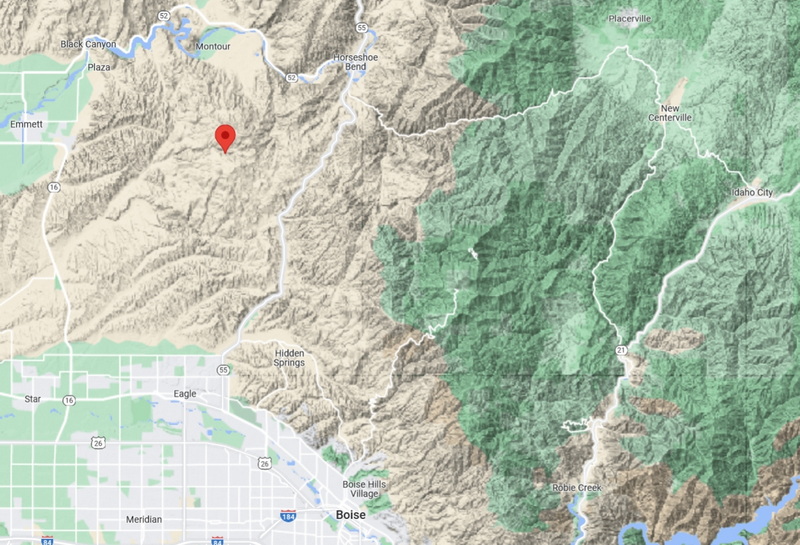
Pearl, Idaho was on the western edge of the Boise Basin Mining District. Located in the foothills NW of Boise, the town was originally located in Boise County but became part of Gem County with a realignment of political divisions in 1915 – after the glory days of Pearl had passed.
Gold-bearing quartz placer specimens were discovered in 1867 along Willow Creek by a local rancher. Some development of the site occurred in 1870 when claims sold for $400/100ft but nothing much came out of it.
With the collapse of silver prices in 1888 – 1892, renewed interest in the gold deposits along Willow Creek allowed development of productive lode mining; by 1894, the mining camp had become the town of Pearl. By 1900, more than 200 people lived in Pearl.
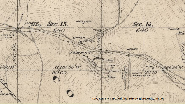
cafe would be at square marking “Upper Pearl”; hotel just to left
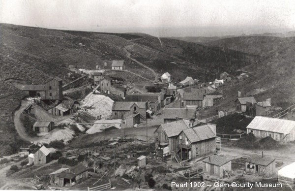
Views of Pearl, circa 1900
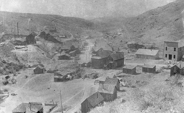
rear view of dual false front buildings center; the gabled building with rear sloping roof left center
“Cafe” hidden in this view; center of picture in corner where road swings to right
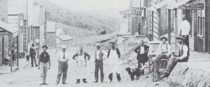
The town prospered during the 10 years between 1896 and 1906. It had electricity before Boise City – the state capital. The faces on these Pearl businessmen seem to speak optimism.
The Checkmate Mine was located on the hillside in town on the south side of Willow Creek. This mine became the most productive of the district with the richest ore. This ore consisted of oxidized quartz containing gold, silver, zinc, and copper. At its peak, the mine employed several hundred miners; Pearl had grown to perhaps 2000 people.
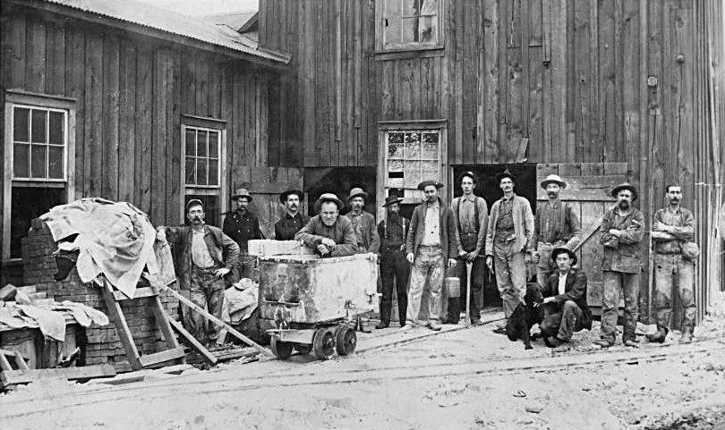
Although the initial ore was rich (3oz/ton – very rich by today’s standards) – transportation was a major obstacle.
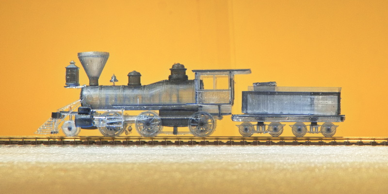
By 1902, the Idaho Northern Railroad had reached Emmett easing transportation woes. However, the railroad never attempted to reach Pearl (except perhaps in the modeling world).
The Checkmate had reached a depth of close to 600′ but increasing sulfides became an issue and the mine was sold in 1905. Another major property went broke, entered receivership and was sold in 1908. By 1910, the population had dropped to just over 100 people of which a minority were miners. By the time the Oregon Short Line Railroad pushed through not far north of Pearl, the mines were beginning to play out.
In 1919, after WWI, another round of investment in the Lincoln Mine – another major producer – extended the shaft to a bit deeper than 500′ but production was poor; the ore had played out. By 1920, the population had fallen to 40; mostly farmers and ranchers.
Interest perked up again in the late 1920s/early 1930s but more development failed to be productive. The post office closed in 1928; this pretty much ended the town of Pearl.
Sporadic small-claim interest continued (and does to this day) but the last resident died in 1950 leaving only remnants of a once thriving town behind.
Off and on interest in the mines extended into the 1980s but there was no attempt to revive the now dead town. The companies performing the preliminary testing removed most of the remaining structures.
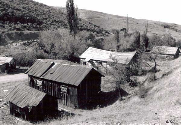
even remnants have been removed
In the meantime, ranching became predominate in the area, the ranchers didn’t care for visitors and the site was bulldozed sometime before 2009.
The last accessible shaft was sealed in the 2010s.
Modeling:
I ran across this photo quite by accident. I was inspired to develop a diorama based on this circa 1904 photo but wanted to find if there were other photos. The version I first saw did not identify the location as Pearl but digging deeper, I found this labeled version. I did not find other photos of this structure though I did discover some questions.
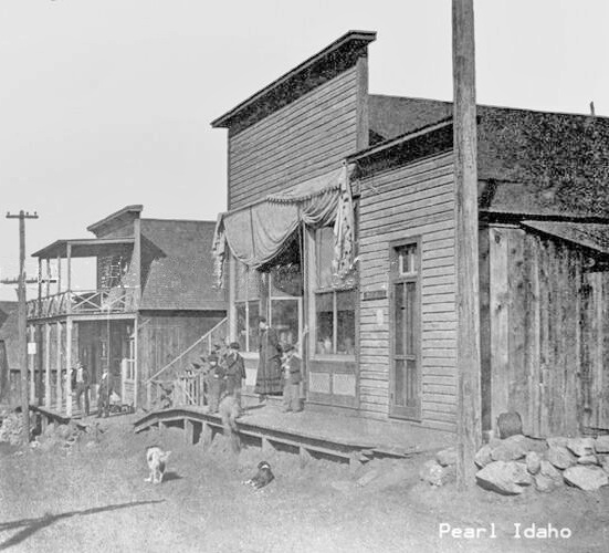
These two buildings are the prototypes for the Pearl Cafe and Pearl Hotel models. The kits include the 3D printed figures … or at east a close approximation.
I wonder what any of these people would have thought if they had known they’d be modeled more than 125 years later …
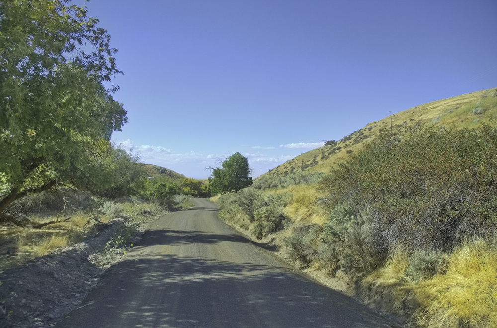
The same location looks like this in 2022:
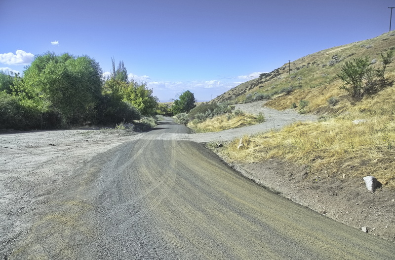
this photo was taken at the same location as the telephone pole in the older picture
The location was determined based on other contemporary photos and modern locations of tailings piles and other such remnants. The road has shifted a bit – the curves eased and the grade lessened; evidence suggests the modern road clips through the nearest building – the cafe – in the photo above.
Similar location techniques place this photo at the same location of the photographer of the gentlemen of 1897. Some modifications have been made over the years but the locations of prospect holes on the hillsides remain the same.
Both sides of the road would have been lined with buildings
Looking north from above the Checkmate Mine in 1906 or 1907. The cafe has been replaced at right center; the hotel (or IOOF hall) remains and is easily discernible. The double false front buildings are on the extreme center-right
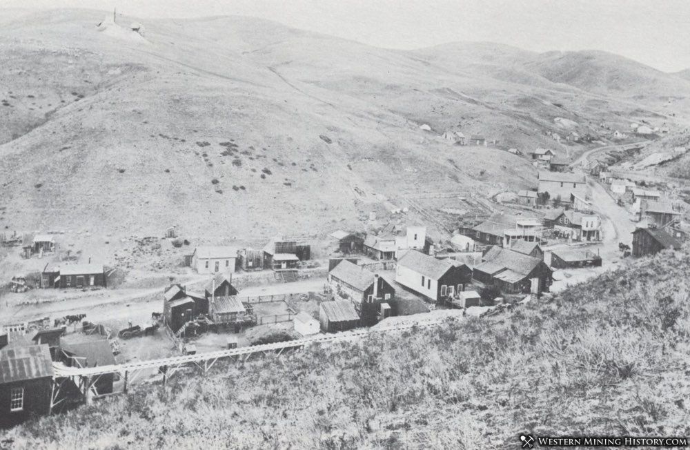
The Checkmate Mine is at the far left on “this side” of the road where it turns.
The cafe is no longer present it would have been to the right of the hotel – with the 2-story balconies
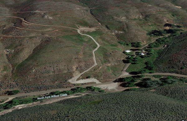
The hillside where the above photo was taken is inaccessible today; Google Earth provides a recent view from a similar location. The main road location has had the corner in town eased and the once public road at the right is now private; the main road today follows Willow Creek to the east. A couple of the structures from the above photo appear to still exist but on the now private road.
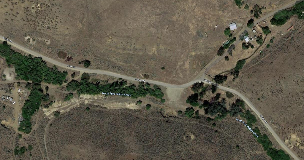
The Checkmate Mine would have been at the open area where the road bends
The curve in the road would have been sharper in Pearl days
Buildings would have lined both sides of the road across the picture
Other than the open area where the mine was, this is all private land with no access
The new road up the hill in the center heads to what appears to be a modern but inactive prospect (<$300 production) working for gold and lead. Its connection with the main road (now Pearl Road connecting between ID16 and ID55) appears to be just to the west of the Pearl Hotel. The altered Pearl Road appears to cut through the location of the Pearl Cafe.